Quantcast
Channel: Rick Potvin's Virtual Circumnavigation of Antarctica to Decide if Earth is Global or Flat
Viewing all 111 articles
Browse latest View live

Shadow of moon (?) circumnavigated the earth!

$
0
0
1. OPENING DISCUSSION - I wouldn't normally discuss the solar eclipse in this blog about the distance around Antarctica however I've been mulling this Aug 21 2017 eclipse over and can't shake it. I've watched many youtube videos and experienced something like a 70% eclipse in Phoenix. The sky DID dim here-- but I didn't look. This discussion I've posted here is just one I've listened to that hits on some good points. The observation that the object in front of the sun STOPPED. Lots of observers noted this.


2. REFERENCES...
eclipse path flat earth - Bing images
"gleason map" - Bing images


3. PATH OF TOTALITY ON A FLAT EARTH. Can be seen on a few videos but I haven't captured the still images yet.


Chippy propsed 33 deg. circumnav. in April 2016

$
0
0
I started this blog in 2015 to explore the idea of travelling around Antarctica to test for distance. It turned out that going south of 60S Lat isn't legal-- so I proposed a trip around 60 or safely north of 60S at, say, 55 S latitude. The idea was to make a distinctive proof that was orders of magnitude different than the distance at the same northern latitude if Earth is indeed flat. For example, the trip around 60S would be 70,000 miles on flat earth vs. 15,000 miles on a spherical earth if we travelled around antarctica. That's more than 4X larger-- and would consistute a definitive proof with a pretty big margin for error possible-- that lets us still get the idea confirmed.

Given the legal problem of going south of 60 however, that trip would be somewhat less than 70,000 miles on flat earth.. I forget what my earlier calculation was without looking but-- lets say its around 50,000 miles at 60 degrees south. That's still a fairly big difference from the spherical 60S which might be around 30,000 miles. I should really sit down and get those numbers.

The reason I'm posting today however is because I found Chippy's video from 2016 April on this idea-- and he proposes a confirmation at 33 deg. S. His reasoning is that we can use the number 33 to throw back at the Illuminati who like numbers like 33. The problem is that he still has to cross over land into several countries. My proposal of 55 degrees south is more easily done on one boat on water without hitting land. I'll write Chippy with this idea.

Here is his entry...

Published on Apr 8, 2016
#FAIR USE# - 2016 "Flat Earth" - I propose a rather simple way of TESTING THE GLOBE - to either PROVE or DISPROVE if we live on a SPHERE - or on a flat, stationary earth.
All that is needed is a way to circumnavigate around a Southern Parallel - to "test the globe" - to see if the numbers are correct - or if we've been LIED to.
On the back of the 1920 John George Abizaid Stationary, Flat Earth Map - there is a simple way to PROVE that we DO NOT live on a globe.
I use the 33° South Latitude in this video as a way to throw that number back in their faces & mock tptb.
Mr. Abizaid, Gleason, Voliva (& others) claimed the distance around the SH is far greater than the distance around the same latitude in the NH, which PROVES beyond a shadow of a doubt that (incontrovertible evidence) that we DO NOT live on a SPHERE.

We've had endless "Flat Earth" talk & speculation. The time is NOW for SOMEONE to step up and form a SAILING expedition.

I've also looked at the 56° Southern Latitude... (all water) and ONE SHIP... set sail from the Southern tip of South America - and travel around in one big circle - if the ship can stay on the 56° Latitude line the entire time, it will prove the earth is not a globe because the circumference will be much greater around than what the globe model claims.

The distance of this journey should end up being two or three times greater than what the globe model claims it is.

Plus, sailing around the S 56° latitude would not require permission from the "Antarctic Treaty" because there will not be a need to cross below the S60° Latitude into the "Southern Ocean". No vessel can enter waters below the S60° without permission.
So, an expedition like this should not need to deal w/jumping through the many Antarctic Treaty "hoops" - as the vessel would not be going anywhere near making an approach towards "Antarctica".

It would simply be taking a cruise around the S56° southern parallel - to see if the distance we've been told is correct.
If the mileage is far greater than it should be... then "the globe model" will have been proven to be false!

Thank you,
Chippy ☺

"Swoop" invited me to Antarctic cruise--> I made counter-proposal.

$
0
0

I'd like to suggest a cruise that we can sell---> Travel completely around the world just north of 60S Latitude to prove that the distance is consistent with either a globe or flat model of Earth. We would book a few hundred "flat earthers" as well as "spherists"... Lots of scientific minded people to moniter stars by charting as well as GPS experts. This could be an ongoing cruise done annually, say. Thank you for the consideration of this in advance if you can. --rick potvin
http://rickpotvinflatearth.blogspot.com/
--------------------------------------------
On Wed, 12/27/17, Swoop wrote:

 Subject: Take a cruise to the Antarctic peninsula and...
 To: rick_potvin@yahoo.com
 Date: Wednesday, December 27, 2017, 9:29 AM
 "Swoop"

My Virtual60,000 mile Trek around 60 S in a movie script.

$
0
0

Stardate: May 10, 2018 by Rick Potvin... Virtual Captain Potvin, that is.

I had a thoughtful commenter wonder if this blog was still operating. It is. In slow motion since I have other life situations I'm dealing with. The life of a virtual captain isn't easy. Nothing is. Neither is what I'm about to say here and now-- stimulated by that last commenter.

As it turns out, I've been absorbed by the ideas of Aaron Dover and others on youtube who point out that it's not possible for passenger jets to be carrying the fuel they claim they carry. It's pretty convincing stuff. It leads to the idea that jet engines are more revoluationary that we've been led to believe because they don't use fuel. They compress air and use that to fly. Or they use the fuel-in-the-air-- either compressed oxygen or compressed nitrogen, to combust. But they do not carry liquid fuel.

This led me to rethink how to circumnavigate the 60S parallel above the Southern Ocean easily, safely, quickly, repeatably, and in comfort--- including a piano lounge on board. On an aircraft, a turbine compressor engine is called a jet engine or a turbofan jet engine or a turbojet. The same type of machine that uses compressed air to move a craft is called a gas turbine engine on a ship. I ran across an argument that explained how Chinese factories can ship America so much cargo is that the transportation cost is negligable since cargo ships are using gas turbine -- or more easily understood as jet engines-- which don't use any fuel-- but rather use compressed air.

In considering how to travel around 60,000 miles above the illegal zone of the southern ocean, I have previously thought about jet airplanes, cruise ships, and yachts-- but I have never previously given thought to the engine that powers these craft before. Now I do. Because if the jet engine is a perpetual motion machine as the conspiracy people are saying it is, then this might make a difference in how we approach the circumnavigation. I certainly don't want to end up wandering around like Captain Cooke did. And I certainly don't believe those sailboats make it around as they claim to in the Vendee races and other similar ventures.

All organized travel agencies that run people to the Antarctic and back are useless in my view because they, despite having the potential to circumnavigate, either will not or cannot do the trip. It turns out that most of them have diesel engines running on LNG. They simply don't have enough fuel. The same would be true of most yachts. It turns out, I read somewhere however, that the jet-engine-on-a-ship called a gas turbine engine-- the gas in reality being compressed air-- which is misleading because we're being led to believe that jet engines are powered by some sort of liquid fuel when they say "gas turbine"-- is being used more and more-- on ships all over the place especially in the military where they've been used for decades to run aircraft carriers for instance.

So the only way to circumnavigate 60S or even to circumnavigate Antarctica, in one fell swoop, is to do it in a craft powered by one of these new almost-magical-high-tech-science-fiction "jet engines"...powered by compressed air-- which is the best way to express it right now. I'm not sure of what is combusted-- it has to be the compressed oxygen and nitrigen which make up most of the air-- if anything. There might be a bit of fuel on board jet planes and ships to get a compressor started but once once start up is accomplished, the thing runs on its own. Look up "runaway diesel" and I think there is some connection between that phenomemon and the jet engine-- which is a controlled "runaway" reactor of some sort-- right out of science fiction that has been covered up for decades.

Now about that movie.

From time to time, commenters here have goaded me into considering doing the trip in reality. I constantly have to remind myself that this blog is about a virtual circumnavigation. In others words, I'm not going. I barely go around the block these days. I go to work and back. I go grocery shopping and back. If I go to a store other than a grocery store, that's a very big deal for me. I'm concerned about the tread getting to thin on my tires with the upcoming summer heat here in Phoenix. I really hate going out and about, more often than not. I'm a highly unlikely candidate for an actual mission around 60S. So I once again put that to rest.

The next best thing I can think of to this blog and virtual trip is to create elements, here, for a full blown 2 hour feature made-for-tv-movie. Of course, the element of the movie that has characters showing off a new jet engine and talking about how it actually works and how this has been covered up by the powers-that-be would be embedded in that movie. I imagine the movie version to be remeniscent of something like Star Trek, with its excellent charaters and high tech machines. Only the 5 year mission might be a 5 month mission to circle the Southern Ocean to test for distance. This is likely too arcane an idea for a movie studio to consider. Maybe I should start with a comic book. Which brings to mind.. comic books... and how jet engines are portrayed in comic books.

Anyway, I'm still around. And this is the general direction I'm thinking. I'll try to update this post in coming days with pretty pictures and diagrams of jet engines and ships powered by the jet engine called gas turbines. I'll try to find the youtubes I've been viewing about the jet engine hoax again-- since I had a hard drive crash on me recently and I lost some links I collected on this. Anyone can easily find them again using "jet engine hoax" and the subsequent suggestions by youtube search.

End of transmission for now.


Virtual Captain Rick Potvin in April 2018... with my last attempt to
grow my hair long before I get too old. 

Trumps July 4th address refers to "the moon"&"Mars" haha.

$
0
0
Haven't updated this in awhile-- still working on regular life. Caught Trump's 2019 address referring to the moon and Mars... what a crock. Ha ha. Like everyone else, I thought he was a maverick but nope. He's just another NWO idiot... all talk no action. I'm done with him. Cancelled my $5/mo support a month ago.

I'm watching the FUELLESS jets fly over my house every day. Whenever I hear one, I run outside and watch and marvel. Youtube is full of proof that these planes are not hoisting tons of liquid fuel in their wings. This will be the basis of any run-round the 60 or Antarctic shore... since fuel depots is such a big thing in antarctica.... though Putin just wrecked a US sub (fake?) in the Arctic yesterday.

Shutdown of the net is a problem along with obsolete browsers, my increasing age and other crap. More in next few days as I do a roundup update here.


I just discovered that my last several posts have had hundreds of visits. Wow. Nobody has contacted me at my home phone landline other than window and vitamin salesmen... and I get tons of junk email. If I have hundreds of hits, among those I would think would be serious visitors who email and phone me. Email me at rick_potvin@yahoo.com and phone me at 623 399 8086 cellphone message.

Quito, Ecuador is on the equator and might be a new reference point for me.

$
0
0
Entry August 31, 2019
.........It's been awhile since I've considered the trip around Antarctica or even 60 deg south latitude or even Chippy's 55 deg south latitude-- to prove a distance greater or less than the equatorial distance of 25,000 miles. A greater distance than the equatorial circumference would be consistent with a flat earth and a lesser distance would be consistant with a globe.
..........I've been concerned more with the powering of the vehicle to be used either on water or in air and discovered that there's a lot of controversy surrounding the jet turbine engine used on both big ships and in planes-- and whether or not they use fuel. It turns out to be a real problem in terms of designing my distance test for flat vs. globe earth.
..........I bumped into a guy from Quito, Ecuador which led to my re-thinking how to more easily determine distance above and below the equator. I would not have to travel around the flat earth or globe-- a huge project-- but simply determine distance between two lines of longitude north of Quito and distance between the same two lines south of Quito. If Earth is a globe, the distance should be the same. If Earth is flat, the distance should be greater south of Quito. It occurred to me that I might contact the University of Quito and propose a study from there.
..........Thinking on this further, it now seems to me that the same should hold true for any latitude, not just the Quito latitude of zero. Theoretically, if my house has a backyard north of the house and a front yard south of the house, I should be able to detect a slightly longer distance between two lines of longitude in my front yard than my back yard. This would save me a trip to Quito. The problem becomes one of accurate measurement and determination of where lines of longitude are.
...........Why don't we see lines of longitude marked out on properties or even as tourist attractions? I watched a few Youtubes on how to determine lines of latitude using the north star, in the Northern Hemisphere but have not been able to go further than that yet.
............The advertised Flat Earth Cruise that hit the news awhile ago is not going around the circle of the flat earth but is a mere gathering on a cruise ship. It might be used to spark an interest in the journey around 55 deg south however. Chippy's idea on that was to avoid the problems 60 deg south might present, legally. I think I had thought of that first but didn't emphasize it as much as Chippy... although the Vendee race I looked at made this apparent.

Owners of Picton Castle sailing ship might be open to 55S Lat. circumnav.

$
0
0
I ran across this sailing ship company recently... http://www.picton-castle.com/. After considering their previous work, I might think about pitching them on a trip around 55 S. Here's a previous trip they made... which is fairly close to 55S...

If they survived the voyage above, then surely they know how to do another voyage a bit more south that that route-- although they may already be aware it's too long and hazardous. I'll find out by emailing them over coming weeks. The downside is that it's an old fashioned sailing ship-- I'd rather find a company that hires newbies, like Picton Castle does, but on a modern jet turbine powered huge yacht....


 I only post this here tonight because I'm looking to update this blog with something relevent and this idea seems mildly feasible. Overall, I'm too overwhelmed with work and day to day survival in Phoenix Arizona to spend any time here and my computer is now too slow to be enjoyable to use, given that most websites demand higher processing power. Still, the Picton Castle might be a viable candidate for proving a circumference greater or less than the equatorial circumference of 25,000 miles-- thus lending credibility to either a flat or globe earth. Certainly if the Picton Castle sailed MORE than 25,000 at 55 S Lat., say 35,000 miles-- then that contradicts a globe right there since the global circumference, according to globe theory, would be LESS than 25,000-- say 20 or 15,000 miles. It'll be interesting to hear what Picton Castle owners write back to me once I construct my pitch to them on this matter.


Another circumnavigation hoax? ...or was this real proof of 15,000 mile Antarctic circumference?

$
0
0
1.0 -- KATHARSIS II MAKES EXTRAORDINARY CLAIM in 2018.
Here it is November of 2019 as I post this and yet an apparent circumnavigation along the lines I've been thinking ought to be done-- was completed around April 2018, a year and a half ago-- by a crew of eight on a sailboat called KATHARASIS II. Here is their route-- a little further south of 60S.


2.0-- NEW INVESTIGATION of CLAIM OF 15,000 MILE CIRCUMFERENCE at 65S
I'm going to open up an investigation into this claim, of course-- I must-- if only to continue this blog's point and purpose. The first problem I have here is that the claim KATHARSIS II is making-- that they completed the circumnavigation in about 3 months and that they travelled about 15,000 miles-- would definitively prove that Earth is indeed a spinning ball and not a pizza shaped flat disc-- at least by my own rules here in this blog. I'll leave aside considerations of a toroidal field in 4-D hyperspace for now. Here's a screenshot of their claim...
 

2.1-- Would any such claim satisfy me one way or another?
How would I judge the validity of the claim? My answer at the moment is that the test run would have to be repeatable-- as all experiments in science. And the test runs would have to reveal more technical data than is revealed in the online sources for the claims by KATHARSIS II. 

3.0-- OTHER CLAIMANTS of CIRCUMFERENCE of 15,000 MI.
They claim that "no sailor in history has managed to circumnavigate Antarctica so close to the continent so fast". I would think that they might have mentioned the VENDEE RACES and another Australia based race organization as close seconds but they do not. See Vendee in my index below-- a race series that I've determined to be a possible hoax.

4.0-- OTHER INVESTIGATORS I'LL SUMMARIZE HERE on this point about the circumference.
Matt Boyland, Chippy.

5.0-- TRANSLATION OF POLISH TO ENGLISH on KATHARSIS II OFFICIAL WEBSITE
5.1 Babelfish?

6.0-- KATHARSIS II RELATED WEBSITES

7.0-- WEB PAGES COVERING KATHARSIS II

8.0-- SIZE OF THE SAILING YACHT PROBLEMS

8.1 The yacht looks too small and frail for this type of voyage-- to me.
8.2 The sailing yacht was subject to no-wind conditions and could not reliably do the trip.
8.3 The diary of the voyage indicates they were overturned and lost all the crew in the water at one point-- unbelievable.

9.0 MAP PROJECTION COMMENTARY
9.1 Why start in SA but end in Hobart? Why not start and stop in Kapztad SA?
9.2 Why go south of 60S?
9.3 How were they legally able to south of 60S?

10.0 Where did they get the idea to do this journey? (or fake it?) From my blog here? It almost seems to be so.

10.0 Where did they get the idea to do this journey? (or fake it?) From my blog here? It almost seems to be so.

10.1 "Around the Ice" seems to be a direct attack on the idea that Earth is flat and that the ice is a wall surrounding Earth.
The expressions on the faces of the voyagers seem to be looking at me, personally, in a weird sort of way-- telling me that my blog here is pointless-- that they've proven the Earth is a flying ball in space because they sailed "around the ice." Special looks from these three sailors concern me... These three seem to be saying-- "What can you do now, Rick?... Nothing. B


11.0 The LOGO seems to be AMBIVALENT and an "in-your-face" affront to flat-earth thinkers.
Notice the perimeter of the logo-- almost a copy of the UN logo with the leaves representing the "ice wall". Here too, despite our seeing an "island" of Antarctica, it's surrounded by a possible symbolic "ice wall". A more generous interpretation would be "ocean waves". Is the ambivalence premeditated and intentional?  


Robot Sailboat "SailDrone" proves Earth is a beach ball, not a pancake or hyperD shape?

$
0
0
1. Robot Sailboat "SailDrone" proves Earth is a beach ball, not a pancake or hyperD shape?

SailDrone says they sailed their robot 22000 Kilometers = 13670 miles in the Southern Ocean around Antarctica-- without mentioning latitude-- but it looks pretty close to 60S. I've previously determined that an Antarctic circumnav would be 60,000 miles on flat earth but 15,000 miles on a sphere. Saildrone claims they sailed 13,670 miles-- in 6 to 7 months around Antarctica in the Southern Ocean (the ocean area south of 60 deg south). Thus, they claim, indirectly, to have proven that Earth is spherical (15,000 mi)-- without having made reference to that fact-- and so far.  Apparently it's not even an issue for them. Ha ha. I'll email them on this point later. I don't believe they can just walk around the planet these days, claiming it's a beach ball-- without at least some reference to proving it to be "not flat". There are lots of people involved in this so I'll start creating a mailing list and hit them up on this point.


NUMERACY is nobody's strong point (except in China)

I have not seen anyone else use SailDrone's data in the context of disproving flat earth. (yet) I'm the first that I know of.  (That's why I'm famous (not)). If you're INNUMERATE, you won't get the first paragraph. Don't worry-- you're in good company. I myself have to read my own paragraph a few times to understand it. Let's review the numbers for the illiterate number people-- s-l-o-w.... 60,000 is the distance around Antarctica on a flat earth. 15,000 miles is the distance around Antarctica on a spherical Earth-- shaped like a big friggin' Beach Ball that flies through Outer Space. So if someone SAYS they sailed around Antarctica and the distance is closer to 15 than 60 thousand miles, they you know they're claiming, indirectly, that Earth is Beach Ball... consistent with Earth being a Beach-- and we're all on vacation. Pina Colada waiter!


2. Rick Potvin chuckles.

After reviewing this SailDrone case over that past hour-- but having  discovered it a few months ago-- it amuses me that SailDrone, a robot, becomes the latest claimant to have proven the Earth is a (beach)ball. I was planning to move my virtual proof to the air using jet turbine engines for the trip-- from my preferred method of a cruise ship-- and this latest claim sort of blindsided me. See this Jet Turbine Engine?

It took me a few months to recoup, regroup and steady myself-- mentally-- on this point of SailDrone's claime-- and to gain sufficiency to make a statement on it. Now, I'll try.

By the way, cruise ships likely use jet turbine engines too-- secretly. And so do cargo ships. And jet turbine engines use perpetual energy-- that's why Chinese imports brought across the ocean are so cheap... transportation adds nothing to the slave labour costs. That's another (far-out) topic. But jet turbines fly over my house every day and there isn't a day goes by that I don't admire how the wings actually do NOT carry tons of liquid fuel-- yet people think they do. What a hoax that is. See more when you search on "jet fuel hoax".

Do you think those wings have tons of liquid fuel in them? Ha ha. No,  you idiot. They don't. What a maroon. (For snowflakes, I'm intentionally insulting the  reader in a friendly way).


3. Tom Rainbow and Doug Platt.
I'll try to use the writing style of Tom Rainbow introduced to me by Doug Platt-- in Analog magazine in 1985. Is Jerry Searcy dead? Frozen? Saul Kent?


4. SAILDRONE with and without a sail...???   Some of the photos and depictions of this robot drone are conflicting. The first photo below shows a kind of box without a sail. Did someone forget or neglect to Photoshop the sail in? The second and third depictions show different solar panel configurations. The last photo shows a horozontal sail attached to another piece but it's missing the bar on the other side. Is this even a device that exists in reality?


5. STRUCTURE of the drone is questionable. 
I have not studied the structure of this marine drone enough to understand how it works. On first appearance it reminds me of the comedian Steve Martin's 1970's act-- seen on the right-- where he pretended that his head had an arrow  piercing it. It seemed funny to me at the time-- but not so much now with today's world. Current comedy is the crazy "sail" of the Saildrone. What the hell is  it supposed to do, set up like that? It seems as moronic or comedic as Steve Martin was to me at the time. This thing is supposed to have survived the Southern Ocean circumnavigation on its own-- as a robot? It's hard to believe. Extraordinary claims require extraordinary proof-- it's been said. Where's the proof?

5.1
Someone posted interesting sail-structure questions in a forum I ran across.... but these queries have not been answered by anyone from SailDrone (of course).

freedomev • 5 months ago
Interesting though one sees they have little understanding of air foils which are far superior and more survivable done right.
 Fact is they could just use a smaller foil, smaller than the sq sail, not the huge one shown for those conditions.
 Being able to do things like closer to shore where a sq sail version could get caught on a lee shore, driven into the rocks, ice, a foil one would easily sail to 30 degree of the wind, taking out if needed.
 Another is solar power is pitiful there when they have sail power that with a propeller could generate far more power 24-7 plus give emergency maneuvering out of say an icebreg's way. Or a wind generator. In those speeds a 12' dia one would make 10x the solar panels output or more.
 From my experience 50' waves in such conditions really don't matter to such a small boat as mostly underwater will just gently go with, though them..
I'll never forget saving a lady friend/neighbor anchored on a boat in hurricane Gloria with 80mph winds getting there by boat wasn't happening so I put on my snorkel gear and jumped into the water.
It was like another world you couldn't even tell there was a hurricane above. I expect it is the same for mostly underwater drones like this one.


6. The INVENTOR Richard Jenkins- ENTREPENEUR-- really?

Richard Jenkins-- SailDrone developer-- has a checkered history to say the least. It's hard to believe when you read it. I won't go into it here. It just seems unlikely. He's a Horatio Alger story-- about a guy who pulls himself up by his own bootstraps and eventually attracts venture capital from the wife of the owner of Google and a guy from Hong Kong who is among the world's wealthiest guys. Now he's selling his SailDrones to various entities trying to moniter carbon dioxide-- which climate fanatics claim is warming our "plane-t"- but which the rest of us were taught that plants use to breathe. (Why don't they plant more trees to use up the CO2? What a concept.) The only interest I have in SailDrone is its claim that the distance around Antarctica is 15,000 miles at 60S... so I'll keep my target in sight on that point.


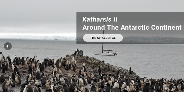
7. Here's the SailDrone in Antarctica waters. (but who took this picture?)


Who took this snapshot? How is this snapshot possible other than by fakery? The drone is supposed to be autonomous and on it's own yet here we have a vantage point where we see the drone from "shore". This lends itself to the idea that the entire program is fake. And that therefore, the claim that they've measured the circumference of Antarctica as 15,000 is phony baloney.


Crater Earth Map changes everything.

$
0
0
The following is so bizarre that I had a very hard time getting familiar with it but it raises some good points.


EARTH IS NOT ONLY FLAT-- IT'S A CRATER IN GREATER EARTH.
This new kid on the block as of August 2020 and now into Sept. 2020-- with a significant new rabbit hole to explore-- is "GodGevLamSte". He's pulling together a lot of various features of what flat-earthers have been talking about. In the past, I've tried to confine my own work to confirmation of a flat or spherical Earth based on the circumference around 60S vs. 60N. "GGLS"'s approach however is too interesting for me to ignore. He's basically saying that the Moon is a reflection of a LARGER or GREATER Earth-Plane in which our own EARTH is seen as a CRATER reflected on the moon. The GREATER Earth-plane is clearly seen in the Moon-mirror... and Earth is clearly seen as Sulpicius-Gallum-M, a crater. The entrance to the GREATER-EARTH-PLANE occurs south of South America into Antarctica and might look something like this...
https://www.livescience.com/59720-curious-stories-about-eclipses.html


NASA'S MISSIONS HAVE FLOWN OVER GREATER EARTH
NASA is not flying "into space" but rather over the Greater Earth Plane. Their photos of "the moon" are, in fact, photos of the surface of the "land beyond the South Pole" described by Admiral Byrd in the 1950's. In the following photo, you can clearly see the Earth Crater in the Plane of Greater Earth.
http://fisherka.csolutionshosting.net/astronote/plan/dhccat/img/Sulpicius%20GallusDMR.jpg


MOON MAP ON WIKIPEDIA IS GREATER EARTH MAP
I lost interest in moon maps a long time ago because, after all, there's only so much to be seen on a "lifeless planet". However, given GGLS's new perspective, the moon-map becomes the Greater-Earth-Plane-Map. In the following Wiki Moon map, you can see our Earth-Crater, Selpicius-Galum on the right and little lower than the middle.
https://upload.wikimedia.org/wikipedia/commons/thumb/7/75/PytheasCraterLOC.jpg/900px-PytheasCraterLOC.jpg

Here's another map of Selcicius Gallus / Our Earth
http://www.refractorland.org/HMA/Images/23.gif


Crater-Earth Dome composed of "blue-ice" under study at McMurdo Station.

Viewing all 111 articles
Browse latest View live